
Project 1
The first project idea that I have is built on the group point map of historic postcard sites
assignment. For a number of reasons, this project really spoke to me. I have always been very interested in exploring historical sites and attempting to understand what the site looked like in the past. Most of the time, that involves going to a specific location, such as the Colosseum, and looking at the physical characteristics of the space. I really liked this assignment because it somewhat turned the notion on its head; we looked at places that had historical significance but we wanted to see what the look like now and what they looked like many years ago. Comparing and contrasting the old and the new is an idea that appeals a lot to me, as does the concept of capturing where a photographer once stood to capture an image.
My project would be to create an group point map of postcard sites all of one specific building or square. I would look for postcards that capture the building or square from various angles and at various points in time and then take pictures where the postcard the view line-up. For the final product, I would create a map that has the points on it, with a picture and a soundbite attached to each point. My hope would be that by looking at my map, the viewer could gain a fuller understanding of the square or building, both in terms of the visual and historical aspects of the site.
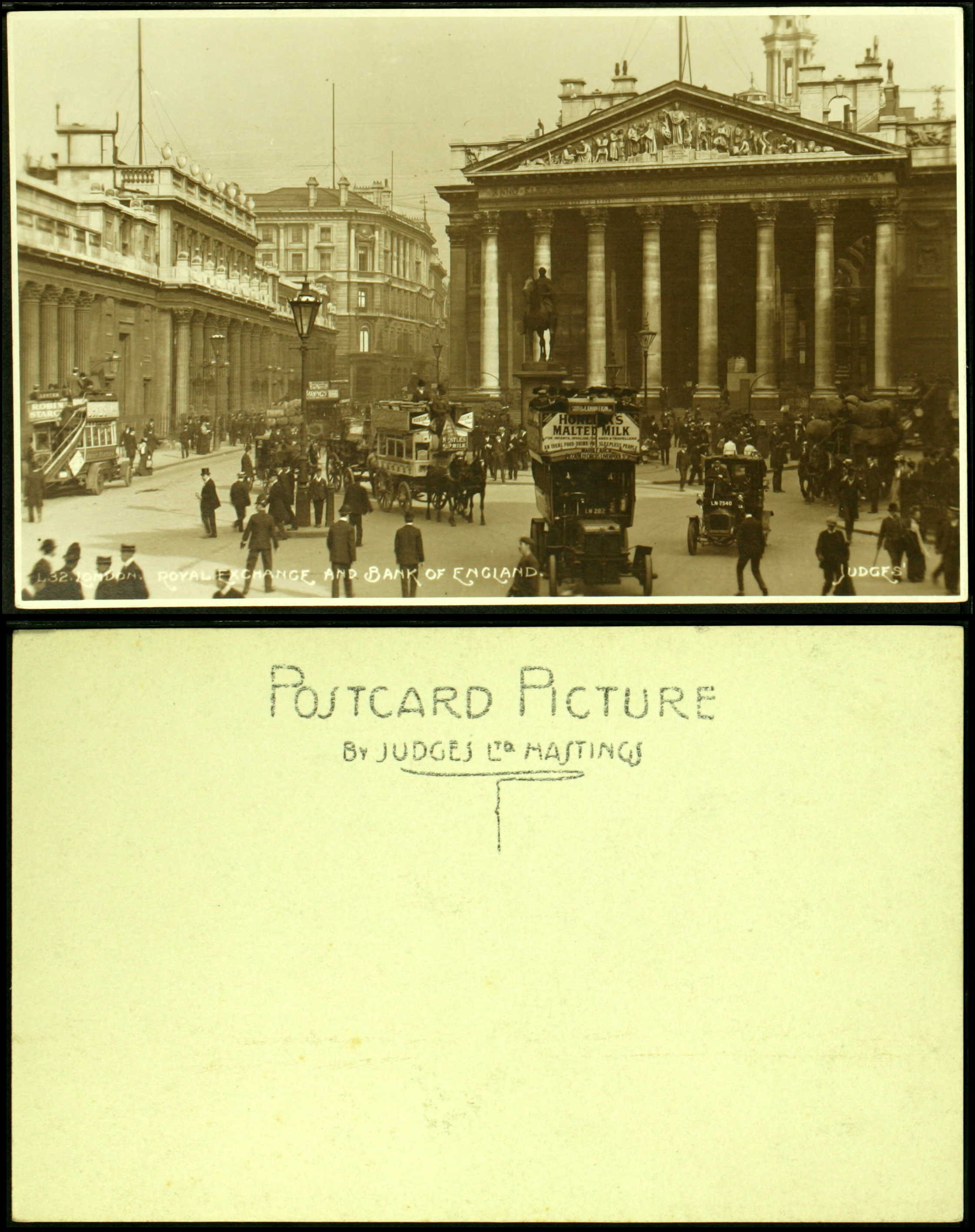
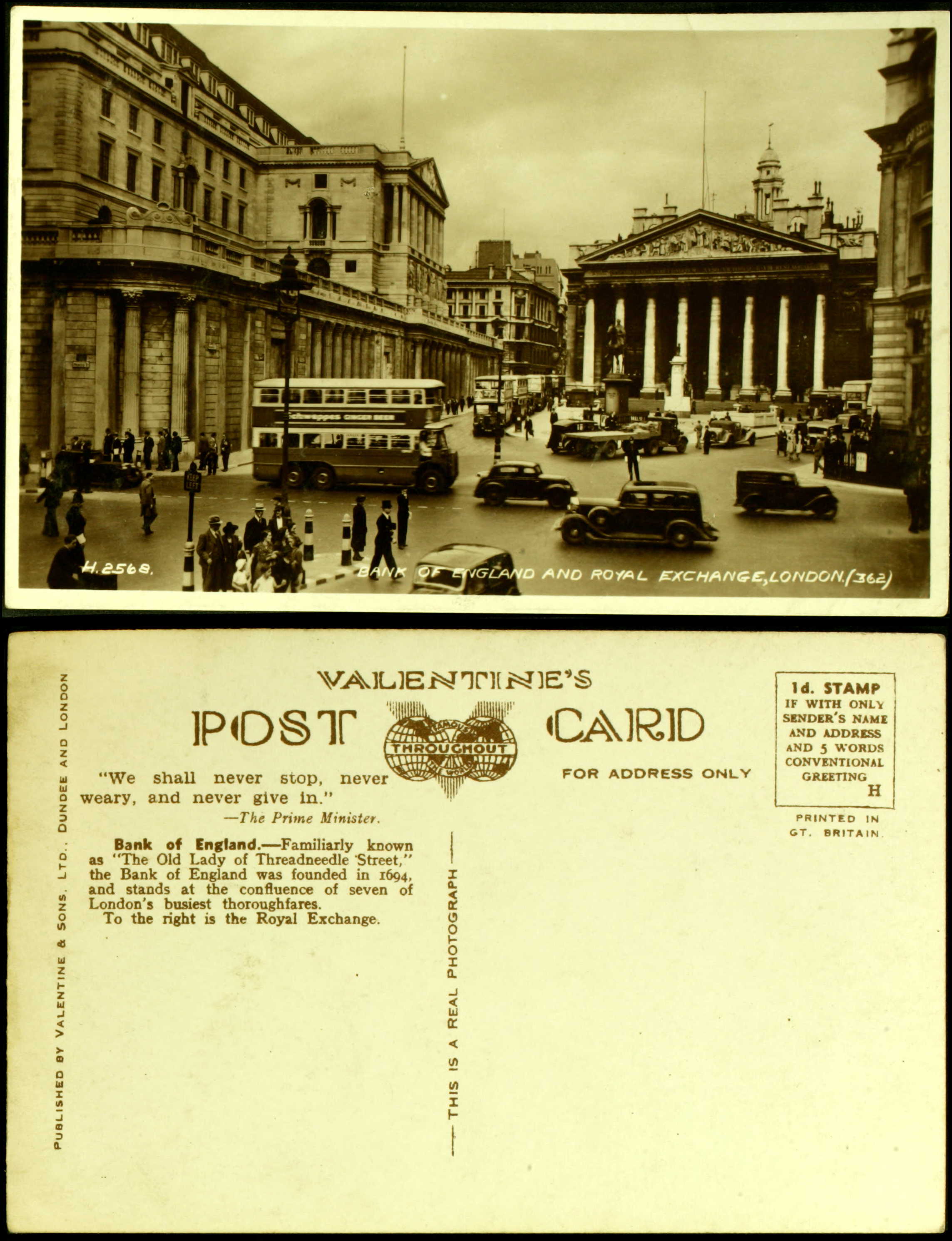
In order to complete the project, I would need to decide on a site and then acquire the postcards. Other than the postcards, I already have all of the material I would need for the assignment. In my research, I have found out that Ancestry.com has a great collection of free postcards that I could print and use as my postcards. So far, I have found that there is a large collection of postcards that contain images of the Bank of England and the Royal Exchange: https://www.ancestry.co.uk/search/collections/postcardsuki/?event=_London+England&keyword=Bank
I have the following questions about the project:
- Can I get instructions on how to create the Google map?
- Is there a better place to find/buy postcards?
I have included pictures of the images that I found on Ancestry.com:
Project 2
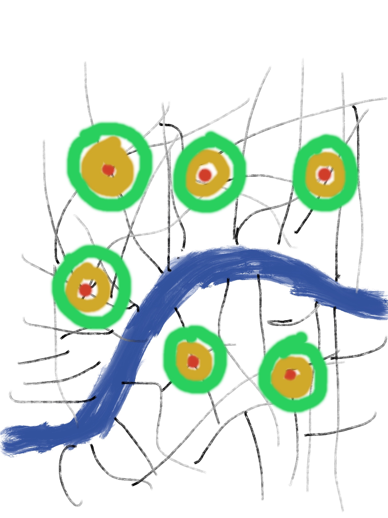
My second idea for a project is totally different than anything we have done so far this semester. I was really inspired by the project we did at Tate Britain, specifically the part of the project where we recorded the sound in the room as we walked around. I was really interested in the idea that even within a room, there are different sound levels in different spaces in that room. I was also thinking about how loud London can be, and at the same time, how quiet London can be in the right time and space. My idea for a project, therefore, is to explore sound within a specific area of London, and how as one moves away or towards a busy throughway, the noise level changes. I would pick a couple of large/busy streets in London, go to a busy intersection on that street, and then walk away from the street, tracking both the sound level and my walk path as I went. I would want to use multiple kinds of audiovisual recording to capture both my walk and the sound levels. Ideally, I would video the walk using a GoPro, use MapPlus to track my walk, and use dB Meter to track the sound level. For my final product, I would create a video on CuteCutPro and combine all of my digital material to create a series of maps. I am wondering if there is any way of creating a map, that perhaps almost looks like a bulls eye, with sound levels pictographically displayed. Based on my research, the best streets would be the Strand, Oxford Street, and Regent Street.
I have included a picture of what the map might look like:
0 Replies to “Final Project Proposals”